
Today the Ottawa River shorelines are lined with sprawling office buildings, high rises, and urban sprawl. Tens of thousands drive along the adjacent parkway each day for work, pleasure, or other everyday tasks.
But centuries ago before colonization, the land was also a hub for trade, ceremony, and sustenance. The Algonquin First Nations people first called it home, setting up communities along what is also known as the Kichi Zībī — translating to “big” or “grand river” — where they fished, hunted and formed connections.
Now part of that historic past is being unearthed, in part due to climate change.
The Ottawa River runs just over 1,200 kilometres with its headwaters in the Laurentian Mountains of Quebec and continuing east along the border of Ontario and Quebec. When it arrives in the Capital, it tumbles over the Chaudière Falls, enveloping both the Rideau and Gatineau rivers into its massive flow, before pouring into the St. Lawrence River at Montréal.
The early 1600s saw European explorers enter the lands we now know as Quebec and Ontario, primarily seeking fur trade routes and other natural resources from the Canadian landscape. Since then, many cultural groups have left artifacts and archaeological remnants that provide a glimpse into earlier worlds and cultures.
A window into the past
The National Capital Commission is a prominent stakeholder in finding and preserving both land sites and artifacts from previous settlements and gathering places.
One of the many projects the NCC is responsible for are archaeological dig sites which offer information about how past First Nations groups interacted with each other and the environment — some of which are available to the public around Lac Leamy Parc, a location that “contains the largest pre-contact archaeological site complex in the Outaouais Region”.
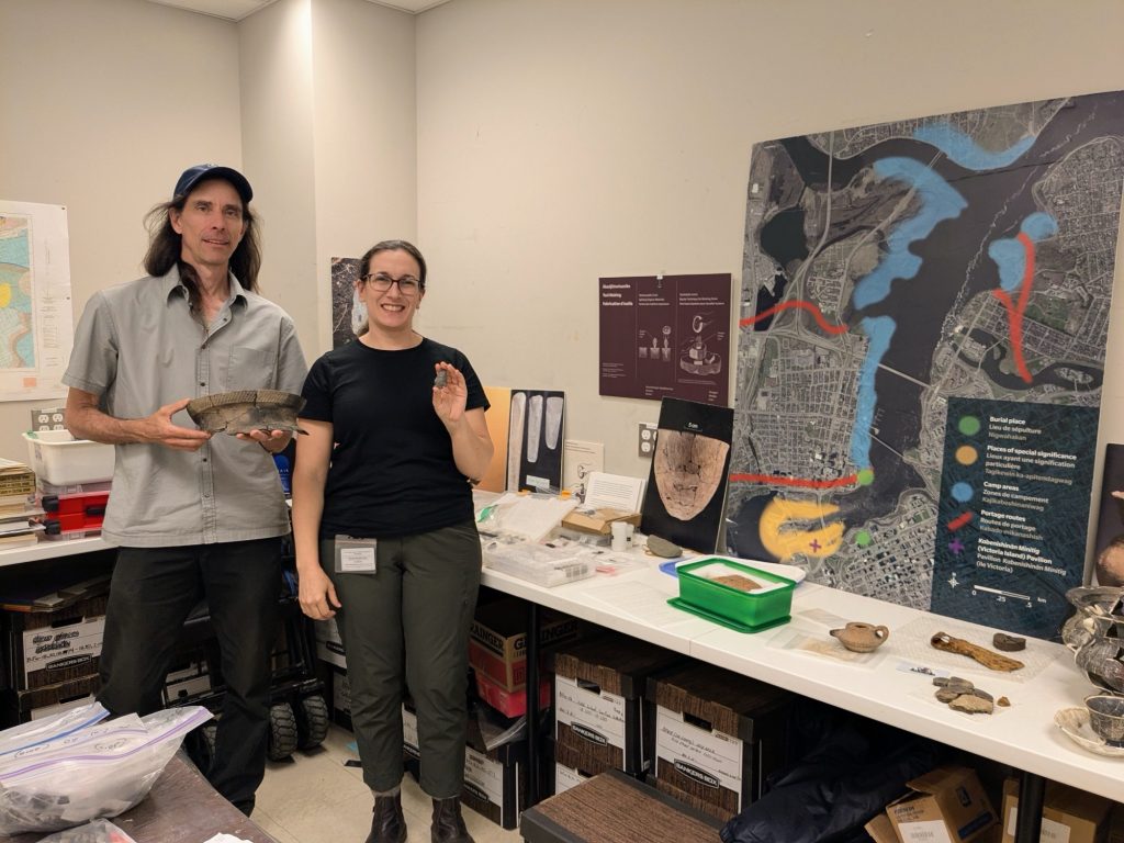
NCC Archaeology Program Manager Monica Maika said “to promote public awareness, one of the reasons why we do our public dig in Lac Leamy is because it’s the largest concentration of pre-contact Indigenous sites in the National Capital Region.”
While the Lac Leamy site hasn’t given evidence of long-term settlements like a village, it does offer substantial insight into both travel and economic patterns of original First Nations cultures.
“For the Anishinaabe Algonquin people, it’s known as Kabeshinàn, or the ‘Gathering Place.’ It’s right at the confluence of three rivers. We have to think about how people would have been travelling in the past and you’re not getting very far, very fast, on foot. When you do want to regroup with your extended family, friends, and other trading partners, you’re going to use your canoe,” said Maika. “What we’re seeing is a recurring use of the site over time of people coming back and trading. We’re getting artifacts from very far distances like Mistissini, Quebec, Lake Superior, and even from the States.”
Maika also spoke to the relevance and urgency of trying to learn as much as possible from sites like the Lac Leamy ones while they’re still there.
“It’s important because a lot of people think about Canada from 1867 to now, but there were people here for thousands of years before settlers,” she said. “It’s important for archaeologists to work with Indigenous communities to gain as much knowledge about the pre-settler use of the land so we don’t repeat past mistakes and can work with communities for reconciliation.”
Weather is playing a negative factor
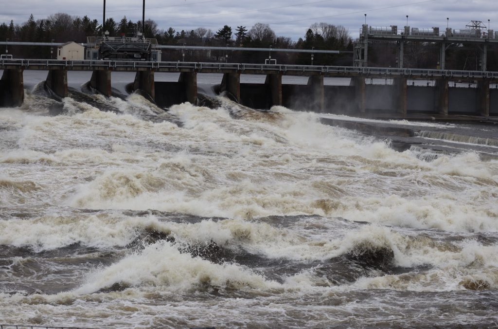
Even with the effects of two hydro river dams — one upstream and one down from the Lac Leamy site, which alters the rise and fall of water levels — the land around Kabeshinàn has shown increasing evidence of loss of soil and the artifacts in it due to more extreme weather events in recent years.
“Regardless of the dams, there’s been stronger rains which are increasing some of the surficial erosion…and there’s been an incredible shift in the topography of the landscape of the site where we do the public dig,” said Maika.
While soil is able to soak up rainfall, there is a saturation point and the water has to go somewhere, often taking the soil and its contents with it.
But it’s not just a matter of an increase in rainfall or flash flooding. The impact of climate change on the land is wide ranging in a variety of ways.
”We also get big wind storms, the derecho for example. We lost all kinds of trees in Leamy Lake Park,” said NCC Archaeology Program Manager Bob Clark. “If they’re right on the shore and they fall down, they fall with a big chunk, with two meters of the shore away with them and all the soil.”
Additionally, a lack of water and rainfall can also have a detrimental effect.
“In droughts, if it’s really hot, the clay dries right out and then it cracks. And then when it rains really hard, those cracks fill with water and break apart. It’s a cumulative thing,” added Clark.
With no end in sight to the increase of climate change, both Clark and Maika said we can expect further loss of valuable historical and cultural artifacts. In a report published by the United Nations Environment Programme in March 2020, it outlined the connection between climate change and flood events.
“Floods are made more likely by the more extreme weather patterns caused by long-term global climate change. Change in land cover — such as removal of vegetation — and climate change increase flood risk,” part of it read.
For the Lac Leamy site, all of this means that not only are artifacts being washed away more readily, but the background and the framework of the history of the land as well.
“We’re losing the context that [the artifacts] were in originally, and it’s the context that can really tell you the story of [the cultures]. Sure, this stuff is cool but if we can’t tell a story, we’re not really getting at the heart of archeology, which is to tell us more about our history,” said Maika. “You don’t find groups of fourteen Indigenous archaeological sites elsewhere in the national capital region — it’s pretty significant.”