
The Kichi Zībī Mīkan Parkway. The Trillium Pathway along the light rail system. Or the Trans Canada Trail near Britannia Beach. These are just some of the many places where Ottawa cyclists can ride for pleasure or to connect with other parts of the city.
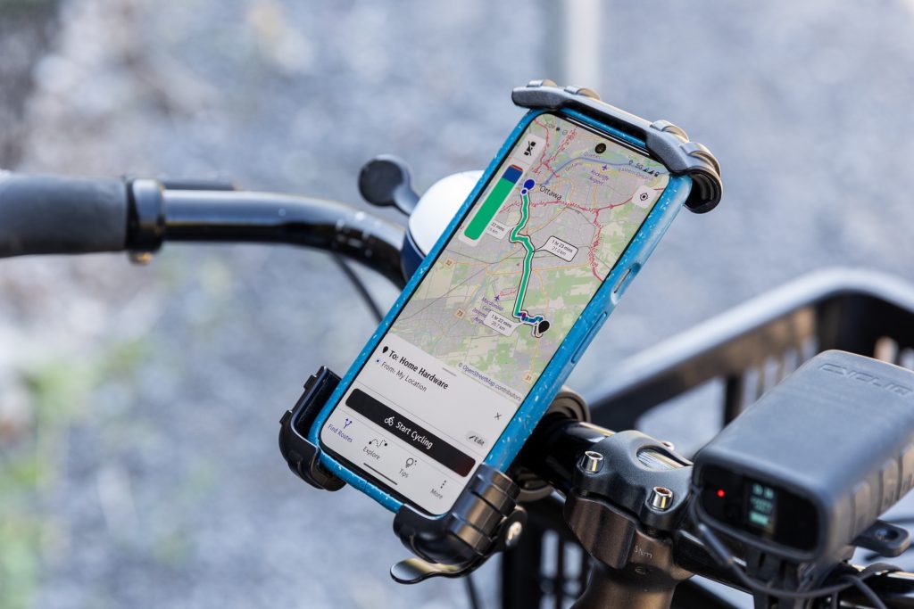
But did you know there could also be hidden routes which take you where you need to go faster? That’s part of the reason why Bike Ottawa has launched a new cycling guide app, which provides safe and comfortable options.
“I’ve been biking a long time. and you know what? My perception of getting around the city has totally changed since I started using the app,” said Dave Robertson, a volunteer with Bike Ottawa and a resident of Hintonburg. “I had my route that I would regularly take to get to work. It might not have been the most direct, but I always want it to be comfortable and enjoyable. I punched in my route on the map and realized there was a whole route I never knew existed – and it was even faster than what I had been taking.”
Robertson said he has heard a lot of these stories from the 4,000 members who have signed up for the app since it was launched a little over a month ago.
The idea for an app originated in 2016. Bike Ottawa had a series of programs online, but they could only be accessed through its website. Then a group from Waterloo Ontario approached the team about turning it into an app-based program people could actually use while on their bikes. About 150 volunteers tested it before the eventual rollout.
“Sometimes a bike pathway or a bike lane might drop you onto a busy street, often unexpectedly. This app fills in those gaps,” Robertson explained. “It gives you a route that you are more comfortable with and it’s colour-coded. Green is good, with pathways or very few residential streets. When [it] gets to blue, it might be a street which has a higher speed limit. If it goes up to red, then it’s a pedestrian place.”
Increasing safety amid a surge in bike popularity
One of the common complaints among cyclists in Ottawa is that trying to bike on busy roads is dangerous. Between 2019 and 2023, there were 62 collisions involving cyclists that resulted in either major injury or fatality. Last year, Ottawa Police reported 123 collisions involving people on bikes.
It can sometimes feel like there are more people on bikes than ever before. Robertson said the COVID-19 pandemic is what inspired people to explore other modes of transportation. A national poll of drivers was conducted by the Traffic Injury Research Foundation in 2020, which found a 152 per cent increase in cyclists across Ottawa compared to pre-pandemic levels.
Ottawa is home to a large set of recreation pathways, including many run by the National Capital Commission. The Capital Pathway Network offers over 220 kilometres of paved multi-use trails which also stretch through the Greenbelt and Gatineau Park. The City of Ottawa provides approximately 325 kilometres of city-owned multi-use pathways, 25 kilometres of physically separated cycling facilities, and 340 kilometres of on-road bike lanes.
Robertson has noticed those pathways are getting busier and said he’s seeing many more parents teaching their young kids how to ride a bike. His advice for the city is to do a better job of connecting the existing networks.
“We have the Transportation Master Plan. An easy thing that you can do is really speed that up by building what we call using quick build infrastructure. A perfect example is Laurier Avenue, which was a quick build project constructed in 2010,” Robertson said. “There [are] little pin curbs there that separate you from traffic, but it’s not a permanent facility. It’s cheap, it’s fast, and it’s relatively easy.”
The app is free to download for all Apple and Android users, and will now be available in other Canadian cities.
You can download the Cycling Guide Mobile App here.