
For the past fifty years, the Queensway has been a normal part of life in Kitchissippi. Also known as Highway 417, this 181.4 km highway has grown over the years to accommodate the growing population to the west and east of Ottawa’s core. Now making up 42 interchanges from the Quebec border to Arnprior, the Queensway is integral to Ottawa’s linkage to the outside world.
It’s easy to hop on the Queensway at one of Kitchissippi’s three interchanges to reach a destination quickly. Tough to imagine that some people in the neighbourhood did not welcome the highway’s arrival with open arms.
The story of the Queensway begins back in late 1892, when the newly formed Ottawa, Arnprior and Parry Sound Railway Company began acquiring small tracts of farmland running west through Nepean Township from LeBreton Flats. Lumber king J.R. Booth was behind the endeavour. He pursued this particular route to access the west as conveniently as he could: with a path that was as flat as possible and on land he could acquire as cheaply as possible. His goal was to serve his vast land and lumber holdings along the line, particularly at the Chaudiere Falls, and later on the south side of Carling in what is now Carlington.
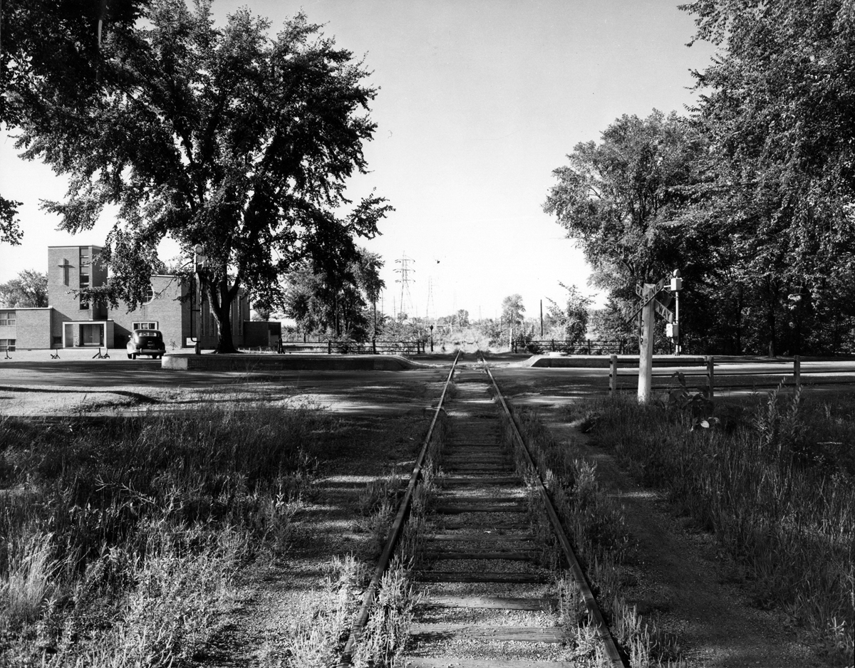
In 1905, the line was sold to the Grand Trunk Railway. The GTR went bankrupt in 1923. The line was taken over by the Canadian government and merged into the Canadian National Railway. Use of the track declined over the years, with the final trains running in 1952 on what was then known as the Renfrew subdivision line of the CNR.
The Greber Plan was published in 1950, under the direction of Prime Minister Mackenzie King, who foresaw a total reorganization and modernization of Ottawa’s road and rail network. One of the key recommendations was the creation of an east to west expressway along the existing CNR line. Thus in 1954, the Federal District Commission (the forerunner of the NCC) began acquiring additional properties alongside the former Canadian National Railway route to expand the corridor from the original CNR right-of-way of 80 feet, to 180 feet. Rail lines were removed and preparations began towards the construction of a much-needed throughway.
Ottawa Mayor Charlotte Whitton was particularly involved in the process. She helped bring together all three levels of government to share the costs of construction. The combination of the FDC expressway, the required expansion of the Trans-Canada Highway, and the need for a local throughway, ensured that all governments had an interest in this project and would likely contribute to it. There was an assumption that a combined project, although more extensive and costly, would actually be less expensive and bring about greater benefit.
The City of Ottawa was given the task of naming the road. Wishing to avoid potentially dangerous-sounding names that had been used in planning of this “expressway” and “throughway,” Mayor Whitton personally selected its unique name. This is how it became known as the Queensway.
On October 15, 1957, Queen Elizabeth II set off an explosion of dynamite at Hurdman’s Bridge, commencing officially the construction of the Queensway.
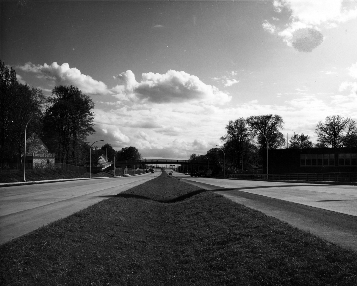
The Queensway was constructed in four phases. Phase one ran from Riverside east to Montreal Road and opened to traffic on November 25, 1960. Phase two from Richmond Road (Bayshore) to Carling (Kirkwood) was opened in October of 1961. Phase three ran from Carling to O’Connor Street. The first part of this phase opened in May of 1964, which completed the Carling Avenue interchange and extended the Queensway to Bronson. The remainder of the phase to O’Connor opened that September. Phase four was the most complicated, from O’Connor to Riverside, crossing the Rideau Canal and Rideau River. The Queensway was completed on October 28, 1966.
Thus it was on May 18, 1964 when Kitchissippi’s portion of this important roadway was first opened. Three interchanges at Parkdale, Island Park and Kirkwood enabled local residents to travel to the east and west quickly, where previously they would have had to travel via Richmond Road or Carling Avenue. The new highway also directly influenced the establishment of Westgate (1954) and Hampton Park (1961) malls, adding more convenience for local residents.
The Queenway permanently altered the map of Kitchissippi. Virtually all of the streets between Island Park and Bayswater were severed, and some homes were now faced with a wall or fence blocking them from their neighbours. In 1967, many streets along this route were officially renamed with “North” and “South” to even further create this division. [story continues below photos]

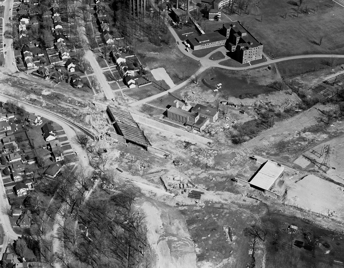
To accommodate the new road, the neighbourhood traffic grid was altered in several locations. Island Park Drive was relocated slightly to the west. It previously ran where Island Park Crescent does now. Some streets were widened and many dead ends were created. A large number of houses – some of them only a few years old, built during the post-WWII housing boom – were demolished. Some homes were moved, which was not an easy task. In one case, the NCC allowed Island Park Drive to be used to transport a house from Hamilton Avenue to Hull, but the move left many trees broken on Island Park and a trail of broken power lines on the Quebec side. [story continues below photos]
There were roughly eight houses removed from each street from Island Park to Bayswater Avenue to accommodate the widening, and some street blocks were wiped out entirely, including the south side of Edgar Street. Many area homes were damaged during the blasting and construction as well. The change to residents of previously quiet streets such as Westmount and Kirkwood, and particularly two-lane thoroughfares such as Island Park and Parkdale, was substantial.
Do you have a story to share about the early days of the Queensway? We’d love to hear! Send your email to editor@kitchissippi.com and you might see it in the next issue.
Dave Allston is a local history buff who researches and writes house histories and also publishes a popular blog called The Kitchissippi Museum (kitchissippimuseum.blogspot.ca). His family has lived in Kitchissippi for six generations. Read all of our Early Days columns right here.